Hiking in Nepal: 1
70 Million years ago, the Indian subcontinent, the fastest moving of all the major tectonic plates, collided with the Eurasian plate as it headed northward across what is now the Indian ocean. Although slow by human standards, the event was (and still is) dynamic by geologic standards. The collision was so powerful that in addition to elevating the Tibetan plateau to become one of the highest land areas on earth, huge wrinkles formed in the Earth's crust at the point of impact. Today, the wrinkles look like this:

We call the wrinkles the Himalayas, of course, and this part of them is called the Annapurna range. I went hiking for four days here, which is considered the most picturesque and accessible part of the Himalaya. It was an incredible experience, I hope these photos convey a tenth of the majesty of the peaks and a hundredth of the beauty of the surrounding landscape.
We started with a cab ride about an hour outside of Pohkara to Naya Pul, a small town on the edge of the conservation area. Just outside of town was a Nepali government checkpoint where I had to show proof of having paid the government fee for entering the conservation area. Just inside the town, though, was a parallel checkpoint:

Here the Maoist rebels also collect a fee, about a tenth of what the legitimate government asks. They wrote me a receipt in case we ran into Maoist patrols in the hills (as it happens, I didn't). The Maoists have declared a unilateral cease-fire, so while they have a bloody past, they have realized that blowing people up is bad for the tourism trade, Nepal's principal industry. Their anger is uniquely directed at the so-called legitimate government of Nepal, which does virtually nothing for the people but does line the pockets of the elite, especially the king. I could write pages about the Maoists alone, perhaps I will later. All of the avowed Maoists I met were unfailingly polite.
Once these formalities were taken care of, we set out along the Naya Pul river, headed north towards the mountains. For the first two hours we walked along the river, and it was like a vain model posing and twisting for the camera: "Think that's good? Well, look at this:"

Or maybe this? Eat your heart out, Colorado board of tourism.

Shortly thereafter, we began climbing into the foothills. All of the area surrounding the Annapurna peaks (at least on the southern side) is divided into steep river valleys. Where the land levels out a bit, there are rice farms, where it is too steep there is only lush forest and narrow paths for hikers.

A lot of the hike, predictably, was vertical. About thirty years ago the Nepalese (with the help of other countries, the US included, I was told) built a stone path through the Annapurnas. These rough-hewn stones serve as a staircase along the sides of the valleys, but more importantly as the only "road" connecting a lot of these small mountain villages. The villages are still agricultural communities, but of course, like the rest of Nepal, they've adapted to
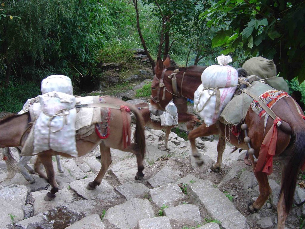 tourism. As such, the goods that the villages need arrive only by means of these stone staircases, thanks to these guys. The trains of 10-20 donkeys laden with, well, everything, pass you regularly as you climb. They're surprisingly fast going up the steep stairs, and incredibly fast going down. In fact, they constitute one of the only serious hazards on the hike, as the poor things don't understand how wide they are, so it's important to get on the uphill side when they pass.
The other danger (at least for me) involved perspective. Frequently you're walking along a ledge with a pretty steep drop on one side. Typically, you have to keep looking down to choose your footing, as the flagstones are uneven and irregularly spaced, and one generally wants to avoid what the donkeys leave behind. So every now and then, you turn a corner and see something like this here on the right.
 This photo is looking mostly down, and a bit across the valley at a distant village. Just 20 degrees from where you're looking for footfalls, you see a town, and then realize that the town is more than a mile distant, beneath you. Occasionally my gaze would shift to a scene like this, and my eyes would be focused on infinity instead of six feet beneath me, which tends to make you stumble. It's not really as life threatening as it is bizarre; I'm not used to looking down on villages from a mile above.
The walk that first day led through three different valleys, skirting the edges of the clefts where the hills meet.
 And of course, at every juncture or fold in the land, a watercourse is waiting to be discovered. I literally cannot count the number of beautiful waterfalls we walked across or around. This is merely one of the more picturesque.
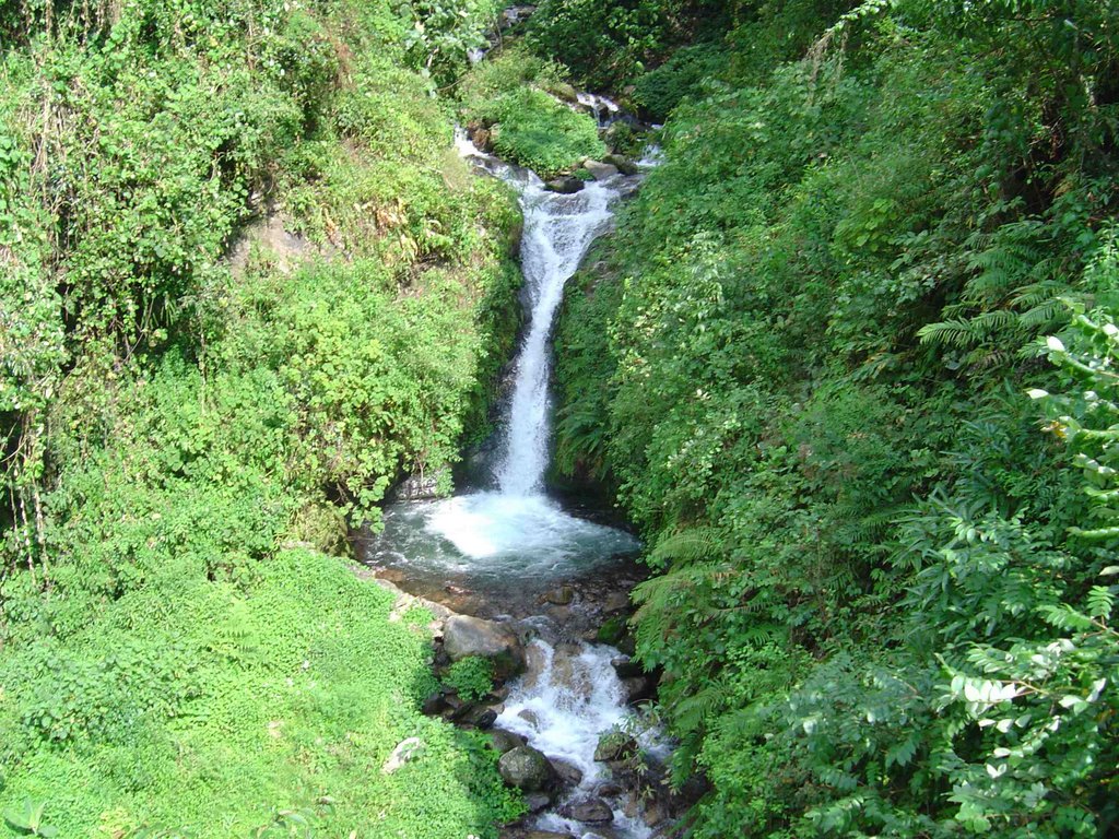
Okay, that's enough for one post. The rest of the trek comes next.
posted by Peej @ 8:10 AM
2 comments
![]()
![]()


2 Comments:
Simply stunning..obviously worth the price of admission. And the weather conditions.....Cool and not to humid I'm guessing. Elaborate. I wonder how many feet you ascended from the jumping off point.
Consummate narrative; the sense of wonder and overall beauty really come through from edification to awe......Thanks man.
Somebody call National Geographic! They need PJ!
Post a Comment
<< Home