Monday, October 30, 2006

Back in Geneva

I'm back in Geneva after eight amazing days in Egypt. I'm going to get working on the blog entries for that amazing country in the next couple of days before I head out of here. Several hundred photos between Nathalie's camera and mine that need to be sorted through first.

I have no idea what the next two weeks hold for me: some combination of time here and in northern europe before I head to the British Isles in mid to late november. A lot depends on the schedules of friends with whom I hope to meet up.

Photos of Pyramids, the Valley of the Kings, Luxor, Cairo, the Nile, and much more coming soon.

Tuesday, October 24, 2006

Safe in Egypt

I've been in Egypt for four days now, three of it spent on a boat cruising down the nile. The sights are incredible and I'm having a great time. So far I've seen Cairo (briefly), Luxor, Edfu and Aswan, where I'm writing from now. Tomorrow we fly to Abu Simbel and then back to Cairo for a couple days before we go back to Geneva. After a couple days in Geneva I plan to set out again, probably for a bit of touristing around Germany before I go meet up with my pal Liza in Hamburg. Photos coming soon.

Tuesday, October 17, 2006

Hiking in Nepal: 3

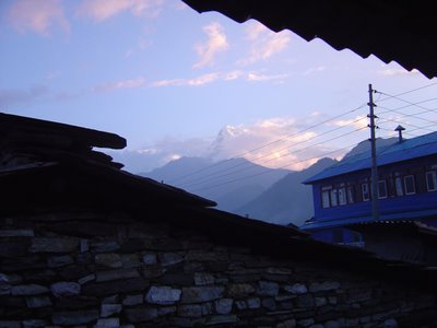
Day three began in the hill town of Gorepani. Our original plan was to climb Pun hill at dawn to see the sunrise over the Annapurnas, but the overcast skies made that less appealing. In Cambodia, Amy and I got up in the dark to watch the sunrise over Angkor Wat, but the clouds reduced this to "gradual lightening" over Angkor Wat instead, which was kind of anticlimactic. So on day three we slept in and left Gorepani around 8 just as the skies were clearing. The views were magnificent. As I wiped the sleep out of my eyes, I gasped and groped for my camera, snagging this shot below and the one to the left for context.

After leaving town, there was a slightly better view of Annapurna south:

These next two were taken at the apex of our climb just east of Gorepani, at an altitude of about 3000 meters above sea level. On both sides there was an incredible, expansive view in the morning light, but the best shots were looking at the mountain peaks to the north.


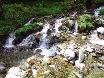
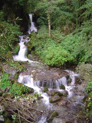
From here we descended to the east headed towards Tatopani. I include below several shots of waterfalls, but for every shot you see here, there are at least a dozen unused in my camera. Some were gorgeous but oddly unphotographable, either because of orientation, lighting, or perspective. I could have easily filled three memory cards with the waterfalls and beautiful streams alone.

On this day I passed a lot more western tourists, including many French folk. As I knew I was headed to Geneva in a few days, I took every opportunity to flake some of the rust off of my French. What was really impressive was the number of families with young children trekking through the hills. One of the great things about hiking in Nepal is the ease of hiring porters to help with transporting gear. At first I poo-pooed this practice, and I still do for otherwise healthy young adults who just don't want to lug their stuff up the endless stone staircases. But for families its a great boon. Sometimes you'd see a party consisting of a guide, a married couple, a twelve year old on her own feet and a two year old in a wicker basket carried by a Nepali porter, with another porter carrying camping supplies. I often pictured my friends the Hamiltons composing a similar train with their little ones. What an amazing experience for young kids, how empowering to have hiked the Himalayas before high school?

We walked for more than eight hours that day, making our way through what Govinda called the "jungle" portion of the conservation area, which was certainly much more densely wooded than what we'd seen before. After the majesty of Vietnamese jungles, though, calling it by that word seemed a bit of a stretch; it was cool and the air was too fine and fresh. The tree pictured above seemed intensely Tolkeinesque. Just to the left is a steep drop of a thousand meters.

At the end of the third day my batteries ran out, and despite three separate attempts to buy replacements in villages we passed, my finicky Sony (which has begun experiencing power supply issues anyway) wouldn't work with them. So I have no pictures of the fourth day, when I was closest to the Annapurna peaks and saw Machuphurchre, in particular, at close range. This was a little frustrating, but I was surprisingly sanguine about it. It's hard to be disappointed when you're staring up at the glaciers of the Himalayas. They make you feel... weak, and slightly absurd, like you should stop wasting time doing whatever it is you're doing and start founding a religion or something.

This may seem like hyperbole, but by far the worst part of the trip was getting back and looking at the photographs immediately afterward. That night I was almost depressed that I hadn't gotten ANY good pictures of the trek. In subsequent days I came to realize that many of the pictures were in fact worth keeping, but the differential between what I saw and what made it onto the web page you are seeing now is too vast to describe. So if you like what you see here, get thee to Nepal posthaste. October and November are by all accounts the ideal months.


The only thing that made it ok to leave Nepal was the knowledge that I would return. Despite being largely on my own, this was one of the best months of my life. The scenery, the people, the food, the wonderful sense of peace and creative energy I experienced were unique.

The Annapurna base camp trek is about twice as long, and approaches the same mountain range from the east, and culminates at a 4000 meter plateau where the mountains surround you on three sides. I need to go home and get a job first, I think, and earn some more money before I can come back, but if you're interested in a weeklong trek in the Himalayas sometime in 2008, let me know. You should go, because the trek I took is supposed to be the less attractive part of the range, and these are really, really bad pictures.

Coming soon: Geneva and Cairo.

Monday, October 16, 2006

Hiking in Nepal: 2

Day 2 of my hike through the Annapurnas began at a little guest house. To the left you can see what was outside my room's window, and below, a little more detail. It was an urbanite-in-the-wild moment as I fell asleep: that dull roar in the distance clearly wasn't air conditioning. Distant traffic? No, it was a mountain river in the extreme distance, but the funnel of the valley pushed the white noise up towards me and lulled me to sleep. Not that I needed help falling asleep after a full day of climbing. Darkness comes quickly in a mountain valley, and the temperature dropped rapidly.


Once I was awake I stumbled down to the dining area (view above), a broad patio between the guesthouse and the kitchen where I chatted in Frenglish with a couple of older Frenchmen in hiking gear. We discussed the similarities between Le Pen and Bush.

In cool air (about 50 f) I at my breakfast of rich Nepali tea and fresh, warm chapatis. The only sounds were the handful of other guests, the teenage daughters who ran the family guesthouse while the parents were shopping in Pohkara, plus the distant roar of the river far below. Around 7:30, we set out on the trail.


This is Govinda, my guide, near the site of a recent landslide. The monsoon rains in August and September always cause a number of landslides in the mountains, most of them pretty small. This one was major- most of a village was washed out and a couple dozen people lost their lives. We would cross this path of this slide a couple more times during the day as we climbed this hillside headed to Gorepani. Huge trees littered the path and were just starting to decompose, but in a couple places the faster growing plants had already colonized the grey path of fallen rock. Some of the larger boulders were enormous- the one above Govinda's head is the size of a semi truck.


The second day was the shortest but steepest; we only walked for four or five hours, only pausing for one break. Then I met a couple of younger Nepali tourists, one of whom had a former classmate studying in Boston. In the photo above, I'm standing near one of the particularly sheer drops. I'd estimate that the opposite slope is a little less than a kilometer behind me, and the drop to the valley flour perhaps half that again. At the end of the day we were near the high point of this particular trip, just shy of 3000 meters above sea level. Naya Pul where we began walking is around 1200 meters, and Pohkara is around 500.


I certainly felt the air getting thinner at this point, but to be frank I don't know how much of that was psychological.

Some of the watercourses were amazing here. Lots of them were narrow and brief but lovely. I often wanted to stop with my book and sit there for an hour or more, and frequently wondered what it would be like to follow the stream uphill to find a more secluded spot.


In the midafternoon, we reached the town of Gorepani where we would spend the night. Here was another family-run guesthouse with a large franklin stove in the middle of the dining room and blessed hot water showers, powered by solar panels as is the norm in Nepal. I sat next to the fire and read my book for the rest of the day. The temperature here was much cooler- down to about 40f at night. It probably would have been even less had it not been for the persistent cloud cover. It was frustrating; during the entire three months I've been abroad, every night I've spent outside major population centers has been overcast, so no good stargazing. Oh well, one can't complain about the view in Nepal.

Days three and four coming up next.

Friday, October 13, 2006

Hiking in Nepal: 1

70 Million years ago, the Indian subcontinent, the fastest moving of all the major tectonic plates, collided with the Eurasian plate as it headed northward across what is now the Indian ocean. Although slow by human standards, the event was (and still is) dynamic by geologic standards. The collision was so powerful that in addition to elevating the Tibetan plateau to become one of the highest land areas on earth, huge wrinkles formed in the Earth's crust at the point of impact. Today, the wrinkles look like this:
We call the wrinkles the Himalayas, of course, and this part of them is called the Annapurna range. I went hiking for four days here, which is considered the most picturesque and accessible part of the Himalaya. It was an incredible experience, I hope these photos convey a tenth of the majesty of the peaks and a hundredth of the beauty of the surrounding landscape.

We started with a cab ride about an hour outside of Pohkara to Naya Pul, a small town on the edge of the conservation area. Just outside of town was a Nepali government checkpoint where I had to show proof of having paid the government fee for entering the conservation area. Just inside the town, though, was a parallel checkpoint:
Here the Maoist rebels also collect a fee, about a tenth of what the legitimate government asks. They wrote me a receipt in case we ran into Maoist patrols in the hills (as it happens, I didn't). The Maoists have declared a unilateral cease-fire, so while they have a bloody past, they have realized that blowing people up is bad for the tourism trade, Nepal's principal industry. Their anger is uniquely directed at the so-called legitimate government of Nepal, which does virtually nothing for the people but does line the pockets of the elite, especially the king. I could write pages about the Maoists alone, perhaps I will later. All of the avowed Maoists I met were unfailingly polite.

Once these formalities were taken care of, we set out along the Naya Pul river, headed north towards the mountains. For the first two hours we walked along the river, and it was like a vain model posing and twisting for the camera: "Think that's good? Well, look at this:"
Or maybe this? Eat your heart out, Colorado board of tourism.
Shortly thereafter, we began climbing into the foothills. All of the area surrounding the Annapurna peaks (at least on the southern side) is divided into steep river valleys. Where the land levels out a bit, there are rice farms, where it is too steep there is only lush forest and narrow paths for hikers.
A lot of the hike, predictably, was vertical. About thirty years ago the Nepalese (with the help of other countries, the US included, I was told) built a stone path through the Annapurnas. These rough-hewn stones serve as a staircase along the sides of the valleys, but more importantly as the only "road" connecting a lot of these small mountain villages. The villages are still agricultural communities, but of course, like the rest of Nepal, they've adapted to tourism. As such, the goods that the villages need arrive only by means of these stone staircases, thanks to these guys. The trains of 10-20 donkeys laden with, well, everything, pass you regularly as you climb. They're surprisingly fast going up the steep stairs, and incredibly fast going down. In fact, they constitute one of the only serious hazards on the hike, as the poor things don't understand how wide they are, so it's important to get on the uphill side when they pass.

The other danger (at least for me) involved perspective. Frequently you're walking along a ledge with a pretty steep drop on one side. Typically, you have to keep looking down to choose your footing, as the flagstones are uneven and irregularly spaced, and one generally wants to avoid what the donkeys leave behind. So every now and then, you turn a corner and see something like this here on the right. This photo is looking mostly down, and a bit across the valley at a distant village. Just 20 degrees from where you're looking for footfalls, you see a town, and then realize that the town is more than a mile distant, beneath you. Occasionally my gaze would shift to a scene like this, and my eyes would be focused on infinity instead of six feet beneath me, which tends to make you stumble. It's not really as life threatening as it is bizarre; I'm not used to looking down on villages from a mile above.

The walk that first day led through three different valleys, skirting the edges of the clefts where the hills meet. And of course, at every juncture or fold in the land, a watercourse is waiting to be discovered. I literally cannot count the number of beautiful waterfalls we walked across or around. This is merely one of the more picturesque.
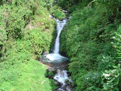
Okay, that's enough for one post. The rest of the trek comes next.

Thursday, October 12, 2006

Safe in Geneva

I've landed safely in Geneva and have met up with my friend Nathalie. This is a beautiful city, and I'm eager to begin exploring it. It feels wonderful to be in some one's (especially my friend's) home and not just another hotel. After three months in Asia, Europe feels like home, and knowing even a little of the language makes all the difference. Posts of the Himalayas coming soon!

Tuesday, October 10, 2006

Back from the mountains; next up: mountains

Okay, I'm back safely from my hike in the Himalayas, and I have many photos to share, but no time. The hike was incredible. My flight leaves Kathamandu in just a few hours and I have a ton of things to do. Hopefully in a couple days I'll post from Geneva (haven't had enough mountains so far, I guess), where I hope to have more time for a detailed account. I'm very sad to leave Nepal, but my time here is done for now. I leave with the confidence that I shall return here, and soon.

On to Switzerland!

Wednesday, October 04, 2006

Hiking in Pohkara

Just a quick micropost. As some of you have observed, I've not been posting as much lately. I was enjoying some downtime in Kathamandu... and enjoying not being in constant motion. But now I'm headed out into the Himalayas for a few days, soI'll be incommunicado until next Sunday. A real post will be coming soon- probably after I make it to Geneva, my next stop, a week from tomorrow.

More soon!

Site Meter